Wizard Recommends
-
 $11000 Welcome Bonus
 -
 $3000 Welcome Bonus
 -
 UP TO $777 BONUS
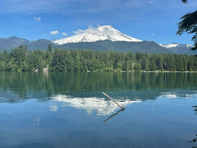
Mount Baker
Before we get to this week’s topic of my ascent of Mount Baker is the weekly logic puzzle, as follows.
Logic Puzzle
An anonymous buyer has agreed to purchase a valuable gem from you. However, you don't trust each other. It is agreed to use a very heavy chest in a public place to place the ring. Any number of locks can be put on the chest. How can you get the gem to the buyer? The chest can't be moved. Any keys sent through the mail could be stolen.
Mount Baker
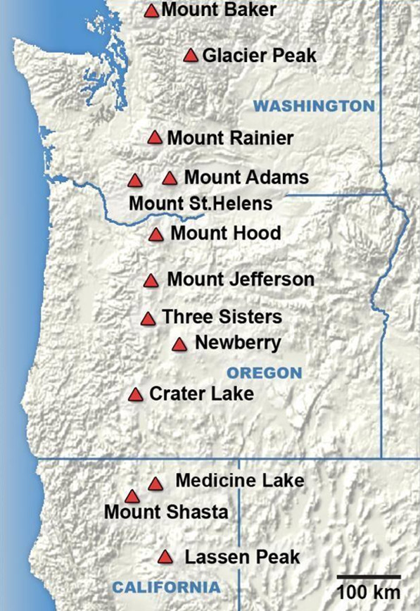
Mount Baker is the northernmost of the US Cascade volcanoes. The following image shows a map of the major ones. There are also more that extend into British Columbia, Canada, which I never hear about anybody climbing. Mount Baker is also the third highest peak of any kind in Washington and the fifth highest of the US Cascade volcanoes.
Many things in and around Bellingham Washington are named after Mount Baker. I figure because it rises prominently and beautifully near the city. Nearby Baker Lake is a popular recreation area. For those who dare, Mount Baker makes for a challenging climb while not being too technically difficult. It is used by many as preparation to do Mount Rainier.
On July 4, five friends from Las Vegas and I attempted to summit Mount Baker. The trip had been planned months in advance. This would be my second ascent of the mountain, after the first on July 8-9, 2018. Here are some quick statistics on the hike via the most common route known as the Easton Glacier.
Elevation: 10,778 feet
Elevation gain: 7,500 feet
Total distance: 14 miles
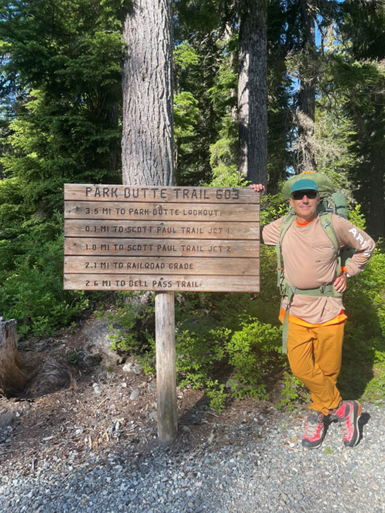
Much like my first ascent, the plan was to do Baker over two days. We met at the Schreiber’s Meadow parking area, where the trailhead is located. About 8:30 AM we headed out. The first few miles of the trail are located in a lush forest on a well-maintained trail. As weascended, the trees got shorter and there was more exposure to the sun. The next stage is going through intermittent patches of snow.
Then comes a section called the Railroad Grade. If my geology is correct, the glaciers on Mount Baker carved out a valley halfway up the volcano. On either side are edges with a steep drop-off into the moraine. The makers of the trail conveniently used the western edge as part of the trail, which is nicely free of snow.
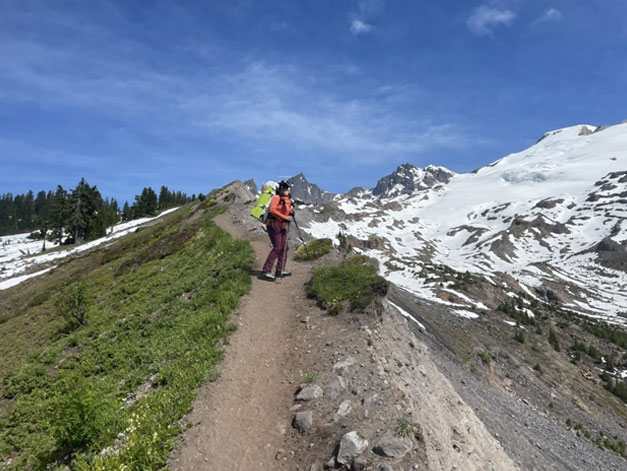
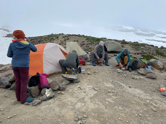
A little past the end of the Railroad Grade is High Camp, where the snow and ice meet the end of the dry land. Some groups camp on the snow and others on hard ground. Our group seized a spot being on dry land vacated by another group packing up. One problem at High Camp is obtaining water. It’s always an option to melt snow, but that requires a lot of fuel. In our case, there was a small pond of water, about the size of a swimming pool, nearby. We purified it out of an abundance of caution.
After a meal of free-dried backpacker dinners, we attempted to go to sleep early, which isn’t easy when the sun sets about 9:30 PM, for an alpine start the next day. All the other camps were doing the same thing. It never fails to happen in these situations that two or more people walk through a field of tents, full of sleeping people, speaking at the tops of their voices.
At about 1:00 AM, I heard my group unzipping tents and getting ready. It was the goal have “packs on” by 1:30 AM. We probably were only ten minutes behind that deadline, which isn’t bad. Of all the groups, we were somewhere in the middle of the procession up the mountain. I could see a row of headlamps moving upward like ants.
About 30 minutes later, we stopped to affix crampons to our boots and tie into long ropes. The purpose of the ropes is that if one person falls into a crevasse, the rest can pull him out. We had practiced a 3 to 1 leverage system back in Las Vegas to do this. The six in our group split up into two groups of three. I was in the middle position of “team 2.”
Shortly after, the last person on my team reported that his crampons were falling off. We had to stop for about ten minutes as he endeavored to fix the problem in the dark. However, it was a temporary fix. The rest of the way up we made about five more such stops to fix these crampon malfunctions. Team One did not wait for us as they continued up the mountain.
By about 5:00 AM, there was enough light to turn off our headlamps. However, the long slog up the ice continued for many hours more. It was nice to have something to look at, for a change.
The main point of interest on the icy part of the climb is a femoral about 75% of the way between High Camp and the summit. This is a place where hot gas smelling of sulfur is emitted from the ground. I have seen others on Mount Hood, Shasta, Rainier and Saint Helens. Most groups stopped at it for a while to take a break and enjoy the sight and smell.
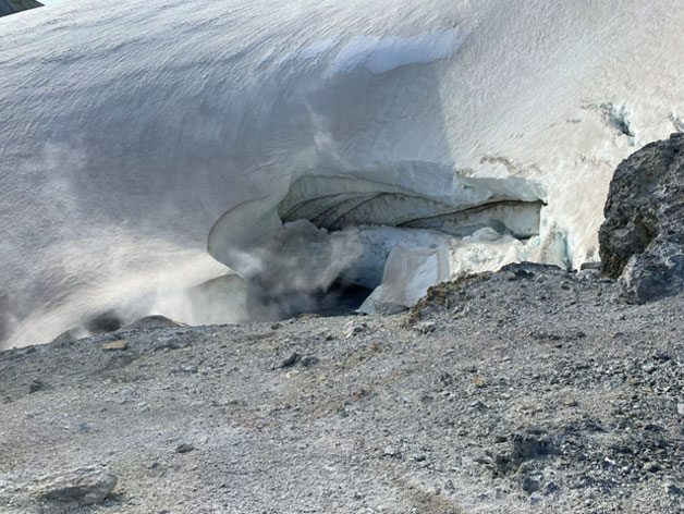
Shortly after the femoral is a section known as the Romal Wall. This is a steep section that demands more attention and skill. I estimate the Roman Wall takes about an hour and a half.
After that, the rest is easy. Many volcanoes are rather flat on the top and Baker is no exception. The tippy top was still about a half mile away, but it was comparatively level and easy. We also could unclip from the ropes, at least temporarily.
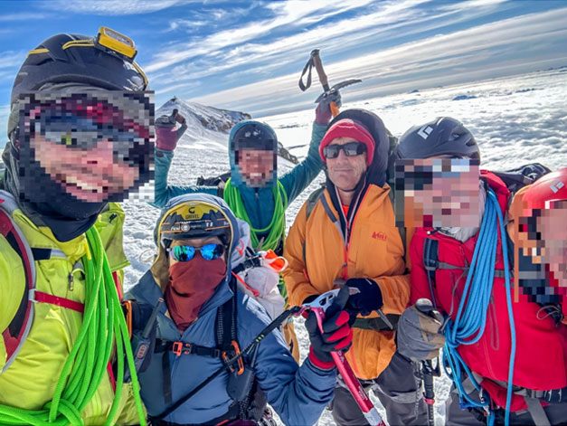
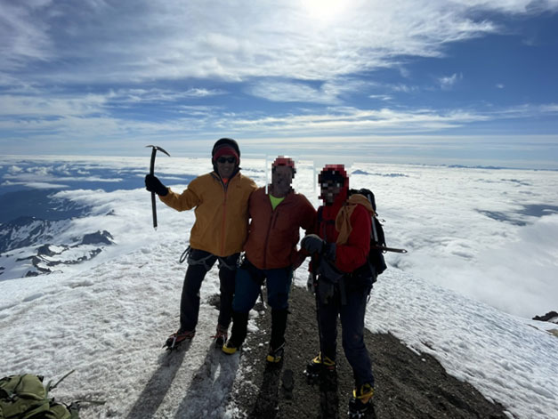
At this point, we met with Team One on their way down. Nobody can blame them for not waiting for us during our many crampon-adjustment stops. However, it would have been more fun and made for better pictures to have the entire group together on the summit.
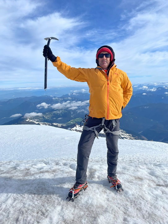
Reaching the summit is always hugely satisfying. I feel achieving goals is a major source of happiness. This time it did not disappoint. Mount Baker is not the hardest mountain I’ve ever climbed, but is somewhere towards the bottom of a top ten list, if I were to make one. After about fifteen minutes, celebrating and taking summit photos, we headed back down.
As we stopped again to reattach to the rope, my teammate with the crampon issues seemed to finally fix them as I don’t recall them falling off again on the way down. About half-way back to High Camp, a cloud set it causing very poor visibility. Between the ice below and cloud everywhere else, all I could see was white. Fortunately, it was easy to simply follow the footsteps to stay in the right direction.
Close to High Camp, we reunited with Team One, who seemed rather annoyed at having to wait so long for us. Back at High Camp, we packed up everything, refilled on water, and headed back down. Another group was happy to take our spot.
The rest of the hike down was uneventful. The strain of the long day was starting to slow me down a bit, but with all the running I do I was able to keep up with minimal pain. The soreness would not hit me until the next day and stayed with me for four more days.
In closing, I would like to thank the leader and organizer of the trip, who I won’t name out of respect for their privacy. I do hope I have encouraged some of those reading this to give it a try themselves. I also invite you to watch a video I made of my 2018 ascent, which can be viewed on YouTube.
Links:
List of mountain peaks of Washington
Logic Puzzle Solution
- Put the gem in the chest and lock it with your own lock. Keep the key.
- Have the buyer add his own lock to the chest and keep the key.
- Remove your own lock.
- Have the buyer remove his lock and retrieve the gem.