Wizard Recommends
-
 $11000 Welcome Bonus
 -
 $3000 Welcome Bonus
 -
 UP TO $777 BONUS
High Sierra Trail (part 1)
Over six days, from June 15 to 20, two friends (Tina and Nolan) and I completed the High Sierra Trail. This is a 72-mile trail crossing the Sierra Nevada mountains from west to east. Work began on the trail in 1928 and is the first long-distance trail in the Sierras meant for recreational use. I’m proud to have completed it and all in our group enjoyed the experience.
Camping in the Sierras usually necessitates a permit. There is no exception for the High Sierra Trail. Fortunately, my friend Tina took care of that. When she invited me on the trip, I did not hesitate to say “yes.” I love the Sierras and haven’t done a backpacking trip of over three days since I section hiked pieces of the Appalachian Trail in the 90’s.
Our first problem to overcome was arranging transportation. The way we worked it out was to leave a vehicle at Whitney Portal, at the east end of the trail, and get a ride the 293 miles to Sequoia National Park, at the west end of the trail. Fortunately, the mother of Nolan kindly provided this ride.
We arrived in the late afternoon on June 14 in the Sequoia (note the four consecutive vowels) National Park. There Tina arranged for a camping spot in the Lodgepole campground. We stayed there because we still needed to pick up a physical permit the next morning.
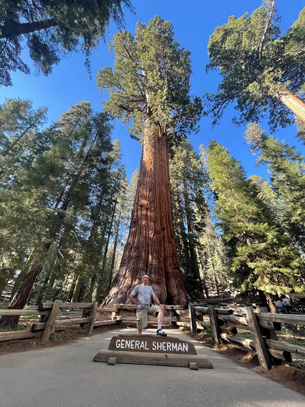
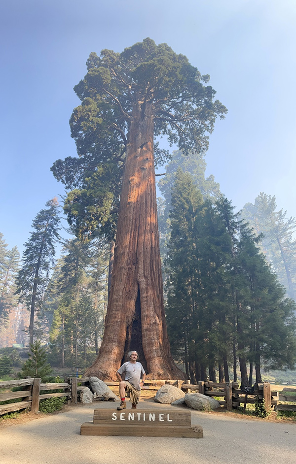
We arrived at the park with plenty of daylight left, so I insisted on seeing General Sherman, the world’s largest tree (measured by volume or weight). Many maps and signs referred to the General Sherman Tree as just the “Sherman Tree.” To me, it is General Sherman, and to omit the “General” is disrespectful of both the tree and history. I would also visit Sentinel, another giant sequoia, ranked about 42nd in size, the next morning. That part of Sequoia National Park is full of such giant trees. We passed by many on the way to the campground.
Getting our permit and getting to the trailhead required taking two separate shuttle busses. The air was smokey, due to a controlled burn in the area. We were concerned they might close the trail due the burn. Fortunately, they didn’t, but we had to endure smokey air the first day on the trail.
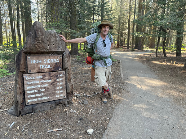
Western terminus of the High Sierra Trail. Note the 60 miles to Mount Whitney. It is then another 11 from Mount Whitney to the Whitney Portal, where the trail ends.
The first day we covered 11 miles to camp number one at Bearpaw Meadow. This section of the trail was moderately uphill the first 9 miles and steeply uphill the last two. The ranger who issued our permit incorrectly said there would be no water at Bearpaw, so we had to lug extra water that last steep two miles, which was not easy. We would later find a running spring at the campground. It just goes to show that information you get about trail conditions is often incorrect and/or dated.
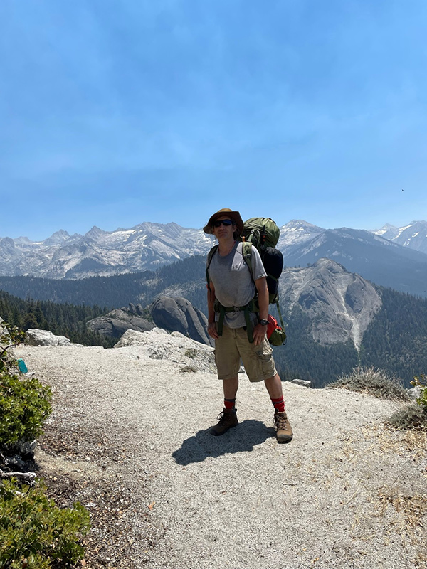
Day one – on the way to Bearpaw Meadow. Our final goal would be well behind the mountains you see in the background.
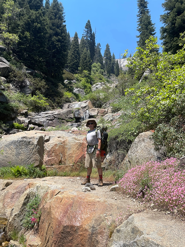
Water was available at many spots along the trail in streams and lakes, like this stream on day one. I usually carried less than one liter of water. A full liter of water weighs 2.2 pounds.
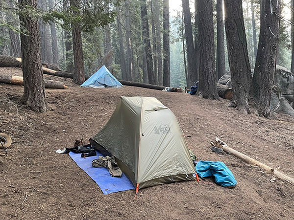
Here is my tent at our first campground. Note the smokey air in the background. We were the only ones there. The campground offers an outhouse and a bear box for storing food and anything else that might attract bears. As mentioned earlier, there was a spring nearby, but I imagine it does not run later in the hiking season.
Overall day one was a success. The distance and net elevation gain were well within our abilities. We hardly saw any other hikers that day and enjoyed the campground to ourselves.
Stay tuned for the next chapter of the hike in next week’s newsletter.
Links for more information: