Wizard Recommends
-
 $11000 Welcome Bonus
 -
 $3000 Welcome Bonus
 -
 UP TO $777 BONUS
Trans Catalina Trail
The Trans Catalina Trail (TCT) is a 37.4-mile route along footpaths and old dirt roads that traverses the length of Catalina Island. When I went camping at Two Harbors, Catalina, last year I did a seven-mile section of it and enjoyed it so much I made it a goal to do the entire thing. A year later, in late July 2014, my 12-year-old son and I returned to the island to (almost) complete the whole thing. This is the story of our five-day trek.
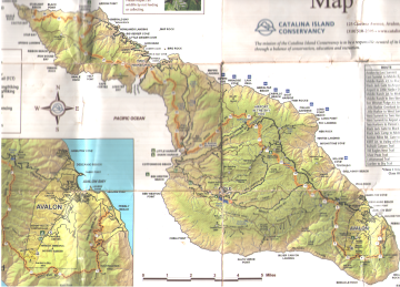
Click here for a full size hiking map of Catalina. The image above is just a scan of my beat up actual map.
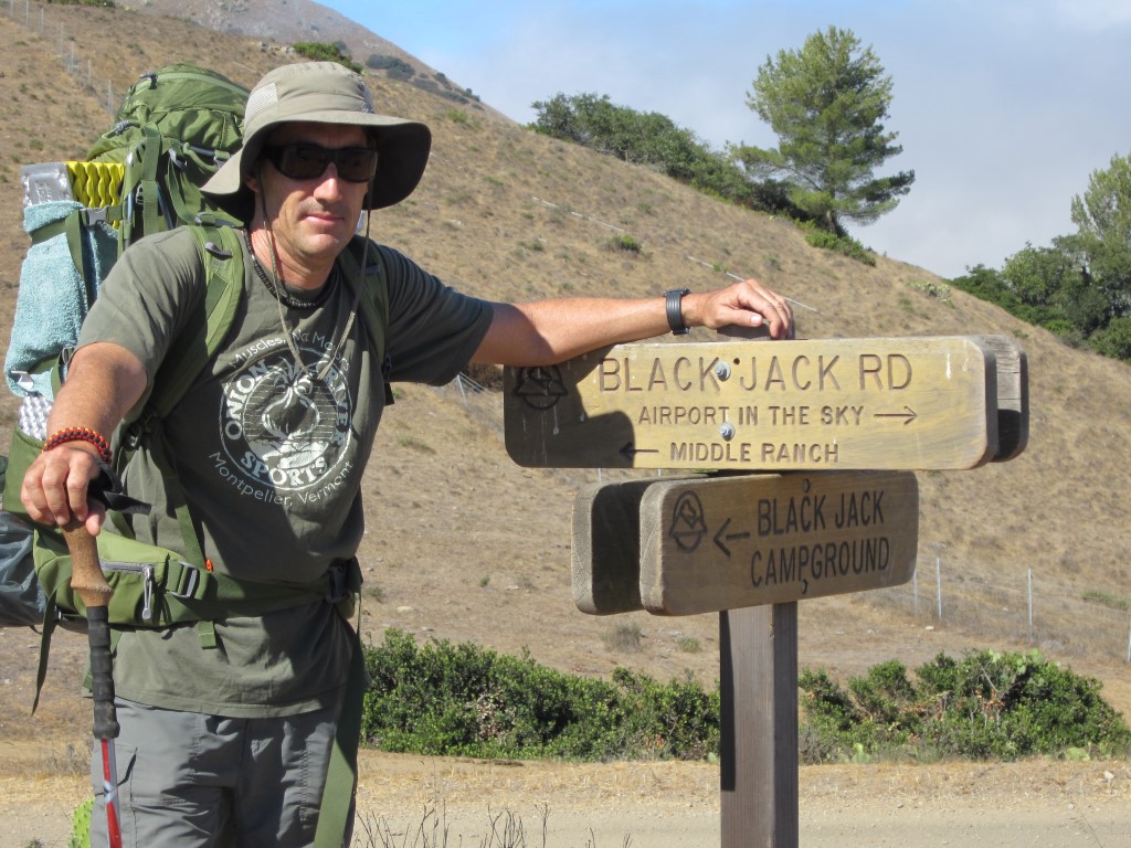
Day 1 — Avalon to Blackjack Camp
On a Monday morning, July 21, we took the 10:45 AM ferry from San Pedro to Avalon. I hadn't been to Avalon in about 30 years, and my son had never been, so we took a little time to walk around and have lunch. We also visited the Catalina Island Conservancy (125 Claressa Ave.) to pick up an island hiking map. The trail is often poorly marked so a detailed map is highly recommended. The Island Conservancy sells a nice waterproof map for $3. This is also where you can get a free hiking permit, which I previously obtained through their web site.
With the light backpack he was wearing, I knew that my son was good for only 7 to 9 miles of hiking a day. However, I imagine that most adults that start from Avalon begin at the trailhead (Pebbly Beach) and hike 14 miles to Blackjack Camp. That was not an option in our case, as my son wouldn't have made it that far, especially given our late start that first day.
In planning the hike, Plan A was staying one night at Hermit Gulch camp, which is just a big flat campground on the edge of Avalon. This would have necessitated about a 1.5-mile steep detour from the trail, each way, at about the 6.5-mile point. I imagine it is probably mostly used by tourists on a tight budget.
Plan B, which I chose, was to cheat and skip the first 6.5 miles of the trail. Instead, we took the Avalon bus to Hermit Gulch, where we started our hike. We then headed up the roughly 1.5-mile trail from Hermit Gulch to the ridgeline and the TCT. This side trail is steep, hot, full of switchbacks, and not very scenic. However, when you finally reach the ridgeline and the main trail, it gets much more level and you're rewarded with great views, including San Clemente Island, which is the island behind Catalina.
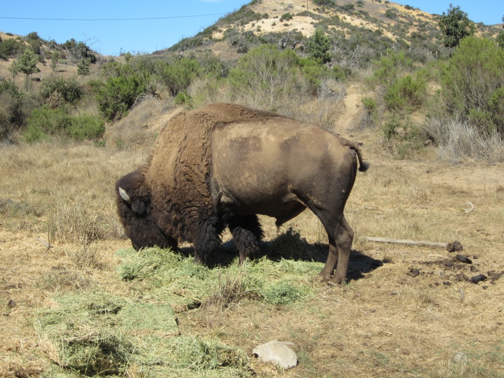
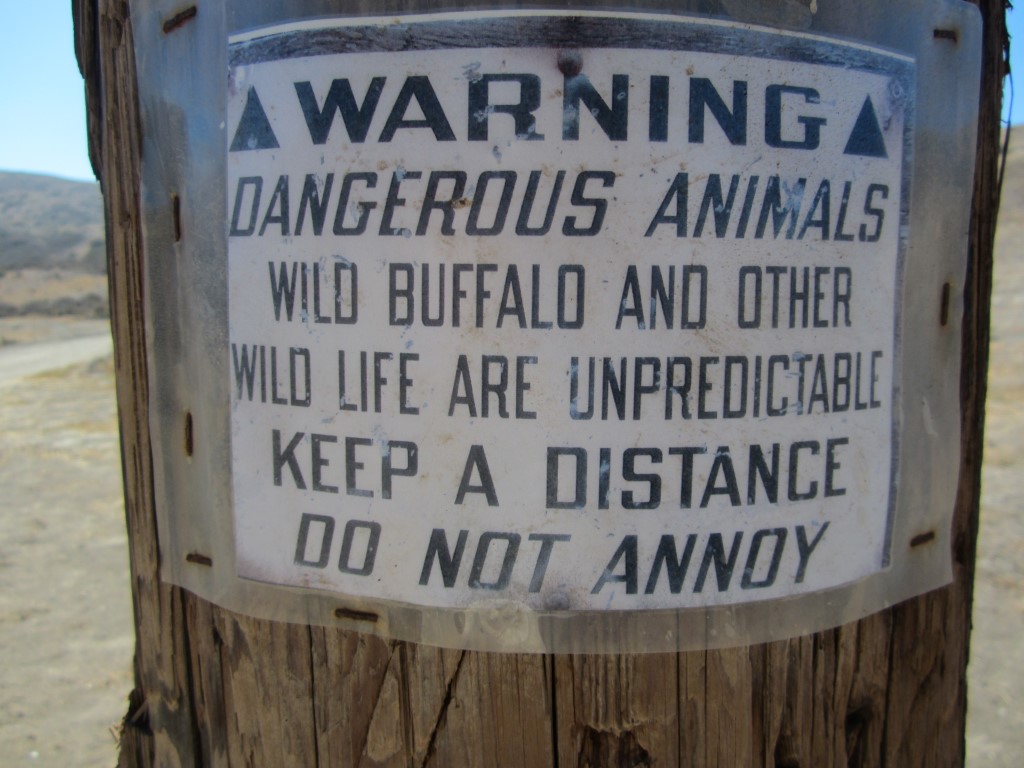
So, I admit it, I'm bad, I cheated, and I didn't officially do the whole TCT. However, I vow to return to Avalon someday and make a loop trail around Avalon to pick up the 6.5 miles of trail we skipped. After finally making it to the official TCT, we followed along a dirt road for about two miles until the trail turned into a footpath off to the left. We followed that the rest of the way to Blackjack Camp. This was an enjoyable section of the trail, going up and down hills in the high interior of the island. We passed this bison along the way. Maybe I shouldn't have gotten this close, but I didn't see a warning sign about approaching them until two days later.
 |
 |
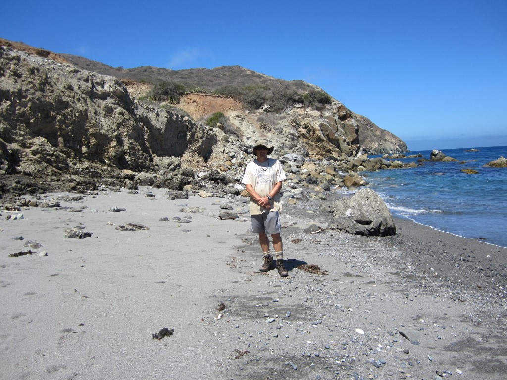
Blackjack Camp is located about 13.5 miles down the TCT. Considering our shortcut, it was about 8.5 miles from Avalon. We didn't get started until about 1:30, so with our slow pace we didn't make it to Blackjack until about 7:30 PM, with about an hour of daylight left.
The camp itself is a nice small campground located among shady trees in the high interior of Catalina. Each campsite has a picnic table and is close to a water faucet. There are reasonably clean and maintained outhouses. There was only one other group of campers when we arrived. I noticed a Catalina Island fox in plain view loitering around their camp, evidently looking for an opportunity to steal or be given some food.
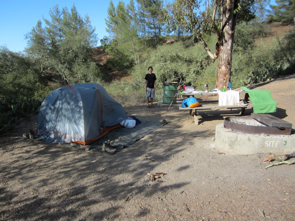
Our spot at Blackjack Camp.
It is always good practice to not leave food out when camping. Seeing that fox served as a reminder, so I carefully packed all our food in a separate bag and took it in our tent at night. I left some cleaning supplies on the table under the incorrect assumption that a fox wouldn't even want them. Mistake number one. When I woke up the next morning I found what I left out strewn around a wide area. I'm surprised I found as much as I did among the bushes. The fox took a bite out of my bar of soap and punctured my sunscreen bottle with his teeth. He also carried off a clean spoon some distance. Lesson learned is to not just pack away food but pack away everything.
Day 2 — Blackjack Camp to Little Harbor
 |
 |
Our second day was an easy one of only seven easy miles, mostly downhill. The first two miles were up and down more hills until we reached the Catalina airport, known as the Airport in the Sky. This is a charming airport in the familiar California Spanish style with a small gift shop and restaurant. We enjoyed a meal there of real food, as opposed to the camping food we had been eating. At this point, my son was complaining about his ankle. There is a shuttle, known as the Safari Bus, which goes from the airport to our next destination, Little Harbor, so I played it safe and put my son on the shuttle and told him to wait for me at Little Harbor as I took the trail.

Airport in the Sky.
This section was the easiest of the entire trail. An open dirt road, it made a gradual decline down to Little Harbor at sea level. Since my son took the shuttle, I loaded his pack with the heavy stuff so I cruised down to Little Harbor in no time. This section of the trail offers great views of the eastern side of the island and the Pacific Ocean. It also goes fairly close to a winery off to the left, which I'm very surprised is even there, given its remote location and water shortage on Catalina.
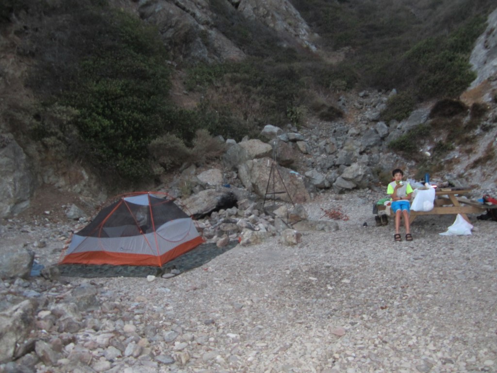
Once I arrived at Little Harbor, we found our campsite and made camp. While Little Harbor is a wonderful campground, we had one of the worst sites, up on a barren hill. Most of the other sites were covered in grass and shady canary palm trees (or perhaps they are pineapple palms, I'm not sure). Lesson learned is, if you're going to camp at Little Harbor, make your reservations early and pick a campsite numbered 12 or less.

Our spot at Little Harbor. Lousy location in a great campground.
The campground features a nice beach in a protected harbor, running water, showers, and twelve nice grassy sites, and more barren dirt ones like I had. This is one of the nicest campsites I've ever seen anywhere. It ranks very high for scenery and solitude.
Day 3 -- Little Harbor to Parsons Landing
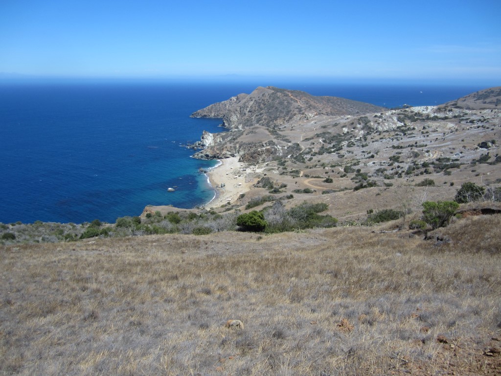
As mentioned at the beginning of this story, I did a part of this trail the previous year. This was the section from Little Harbor to Two Harbors. In the interests of minimizing my time on the island, we skipped this section and took the Safari Bus from Little Harbor to Two Harbors.However, I will say that from memory this is the best section of the TCT. It is a footpath that follows a ridgeline along the west cost of Catalina. As we hiked it, a refreshing ocean breeze cooled us down in the middle of the hot summer. The views of the ocean and Catalina hills were spectacular. Even if you never do the entire TCT, if you're ever in Two Harbors I would suggest doing this section. You can always take the Safari bus one way and hike it the other.
To save time, we took the 10:30 AM shuttle to Two Harbors. After an enjoyable "buffalo" burger and beer at the Harbor Reef restaurant, we got a late start to the Parsons Landing campground. The first mile or so is a level section along the isthmus between the two harbors for which the campsite is named. However, you then make a sudden right turn and hike a steep hot uphill section for three miles. As we started, we encountered two hikers going the other way who warned us it was brutal and suggested taking an alternate, level route on the other side of the western part of the island. However, I would have nothing to do with it. I already cheated once, skipping the first 6.5 miles of the trail, and didn't want to do it again.
This section of the trail was steep, brutally hot, and boring. It was along a dirt road with few good views of anything scenic. We had to ration water because we brought only so much and were extremely thirsty. At least near the summit there were views of Santa Barbara Island, which I had never seen before, since it is too far from the coast to be seen from the mainland. Once we finally made it to the top it was just as steep going downhill. Every half mile or so a bush offered a tiny bit of shade, but otherwise this section of the trail is totally exposed to the blaring hot sun.
When we finally made it to Parsons Landing I thought we would be rewarded with a small remote campsite. When I booked the reservation, the only campsite left of eight was number one. I had a mental image of a small quiet campground like at Blackjack camp.
Our spot at Parsons Landing.
I was in for a rude awakening when I saw about 200 Boy Scouts there. While there were still only eight sites, each was huge and could have hosted 20 to 30 people easily. I felt very out of place as the only non-Scouts there, even though I used to be a Boy Scout. A few adult leaders eyed me suspiciously and carefully but politely inquired what I was doing there. Fortunately, our site, number one, was at the end and in a protected cove out of view of the other campsites. That afforded me some privacy but I felt confined to my little space there, not wanting to be subject to any more glares or questioning. I might add that, quite by coincidence, my son saw three friends of his from school in the group at campsite number 2. What are the odds? I encouraged him to play with them but they were quite busy with Scouting activities, including digging out sleeping pits in the sand.
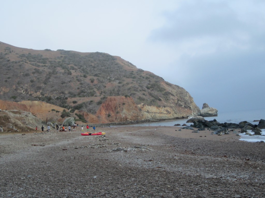
Looking down the beach at Parsons Landing.
Day 4 — Parsons Landing to Starlight Beach and back
The next day it was bittersweet to see the armada of Scouts leaving in canoes back to their main Boy Scout camp at Emerald Bay down the beach. While I would have enjoyed the beach mostly to ourselves, I wanted to get an early start for the day's hike while it was still fairly cool. I was told a new batch of Scouts would arrive that afternoon, so I didn't get to enjoy the few hours of solitude in between.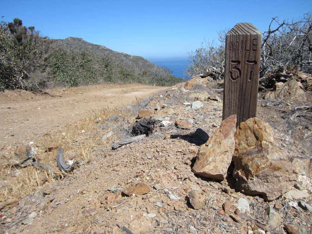
Nearing the end!
The section from Parsons Landing to the trail terminus at Starlight Beach is much like that of the day before, but more like an M shape in terms of hill climbing, and had better views. I also enjoyed a lighter pack, leaving most of our stuff back at Parsons. Nevertheless, this section was still steep and hot. This was also our longest hiking day. Each way was about 4.5 miles, so 9 miles round trip.
When we finally reached Starlight Beach I must say it was rather anti-climactic. Starlight Beach is a small rocky beach exposed to the hot blaring sun. At least I got to enjoy an ocean swim as a seal watched my every move from the water. After that we retraced our steps back to Parsons.
 |
 |
As I looked down at Parson from the hills above, I could see the flotilla of Boy Scout canoes but was happy to see about half of the Scouts walking back to their main Emerald Bay camp. When we arrived, there were still about 100 Scouts, which was pleasantly less than the previous day. I killed the rest of the day swimming, taking a nap and reading a book. It was too windy in the early evening to light a fire.
Parsons Landing from hill above.
I should also mention that unlike the other campgrounds, Parsons has no running water. I was given a quota 2.5 gallons in a locker. I picked up the key to said locker at the visitor services office in Two Harbors. They gave me the key to a second locker, should we need more water and firewood, at an additional expense if I used it. However, we barely managed to get by with the original 2.5 gallons and some smaller water bottles the Boy Scouts abandoned on the beach. I also wish to note that while I paid for the campsite by the day, we was only entitled to 2.5 gallons of water and a bundle of firewood regardless of how long we stayed. It would seem fairer to provide a certain amount per day stayed.
Day 5 — Parsons Landing to Two Harbors
After the brutal Day 3, there was no way I was going to do that section twice. On my previous camping trip the year before we rented bicycles and rode down the dirt road from Two Harbors, past many yacht clubs and summer camps, to the main Boy Scout camp at Emerald Bay. The distance is about the same 7 miles as taking the TCT from Parson's Landing. So we took the nice and level coastal route back to Two Harbors. We arrived with about five hours to kill before our planned ferry back to the mainland, so I switched us to an earlier ferry at $10 additional expense.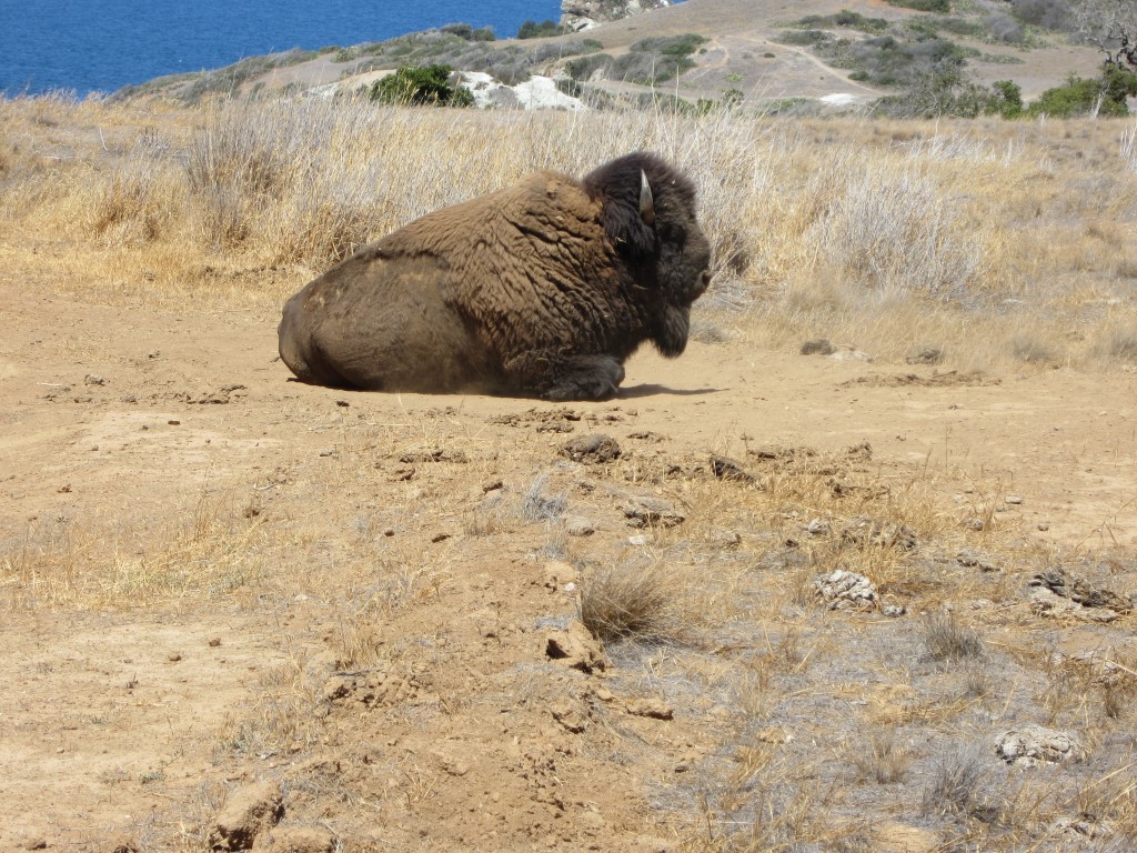
Who can resist a bison picture? This was one grazing near Parsons Landing.
In conclusion, the TCT definitely has its pros and cons. For being so close to Los Angeles, we encountered almost zero other backpackers on the trail. Just two other small groups section-hiking it. However, we did encounter big groups of non-backpackers at every campground except Blackjack. As mentioned, we did the trail in late July and it was HOT, and this is coming from someone who has lived in Las Vegas the last 13 years. If given the choice, I would highly recommend going during a cooler time of the year.
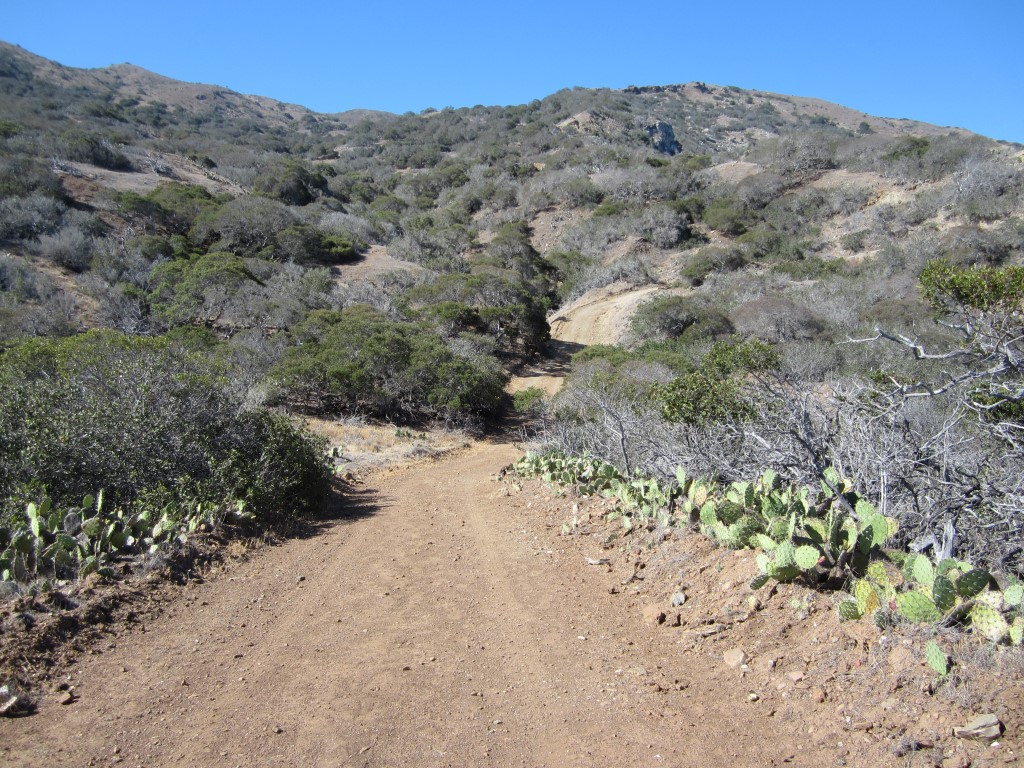
Typical scene on the TCT.
In retrospect, I would recommend most other hikers initially forget the section west of Two Harbors. Start at Avalon and end at Two Harbors, or vise versa. The Catalina Express ferry serves both cities. If you really enjoyed it, you can always return and do the west end another time. Should you do the west end, I highly recommend doing what we did and follow the coastal route one way.
Let me also emphasize bringing the Catalina Island map from the Catalina Island Conservancy. The TCT ranges from very well to very poorly marked, depending on the section. Generally speaking, the further west you go, the worse the signage is. You will see many forks in the trail and roads with no signage at all. At other times, you'll go long distances without seeing any trail markers and you will wonder if you're even on the right trail at all. While there is a milepost every mile, they are small and easy to miss. Maybe I doubt myself too much, but I found myself referring to the map at least once an hour. Finally, anywhere, when still in doubt, take the more well-worn path.
While the TCT has its highs and lows, both literally and figuratively, I'm glad I did it and left feeling I truly "did" Catalina.