


Malinche
I’m proud to say that on Jan 9, I climbed Malinche, the 6 th highest mountain in Mexico. In case you don’t know, central Mexico is covered in several volcanoes. One of them, Popocatépetl is currently active. It was the goal of three friends and I to climb Malinche as a warm-up for Pico de Orizaba two days later, which is the highest mountain in Mexico. I’ll write about that next week.
First, some quick facts on Malinche.
Elevation: 14,636 feet = 4,461 meters
Elevation gain on the standard route: 4,193 feet = 1,278 meters
Location: The summit is on the border of the states of Tlaxcala and Puebla. The approach is in Puebla.
Distance of main route: 7.5 miles round trip.
The drive from the center of Mexico City to the Parque Nacional La Malinche (Malinche National Park) is only three hours away and it is all on paved roads. In our case, we camped for free at a small and rustic campground at the beginning of the main trail. It would be hard to describe where it is. If you’re serious about climbing Malinche, do a Google Maps search on “Punto de cobro para subir a la Malintzi” (Point to begin to climb Malinche). There is a nicer paid campground right next to it, which I can’t speak to.
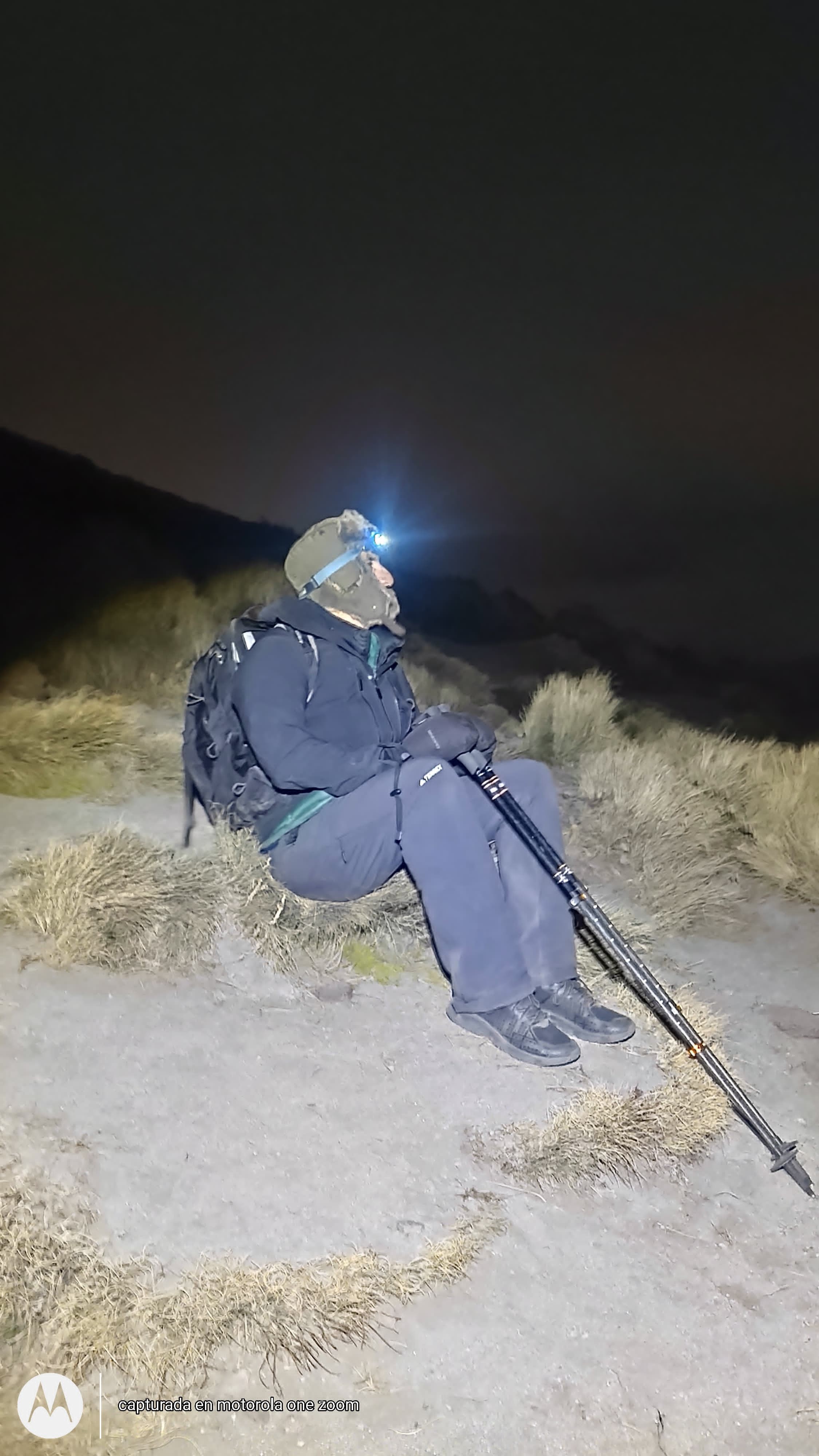
Upon arriving, we set up tents in a field among lots of stray dogs and tried to get to sleep early for a 2:00 AM start. During the quiet night, I could hear Popocatépetl erupting in the distance. I could also hear stray dogs fighting.
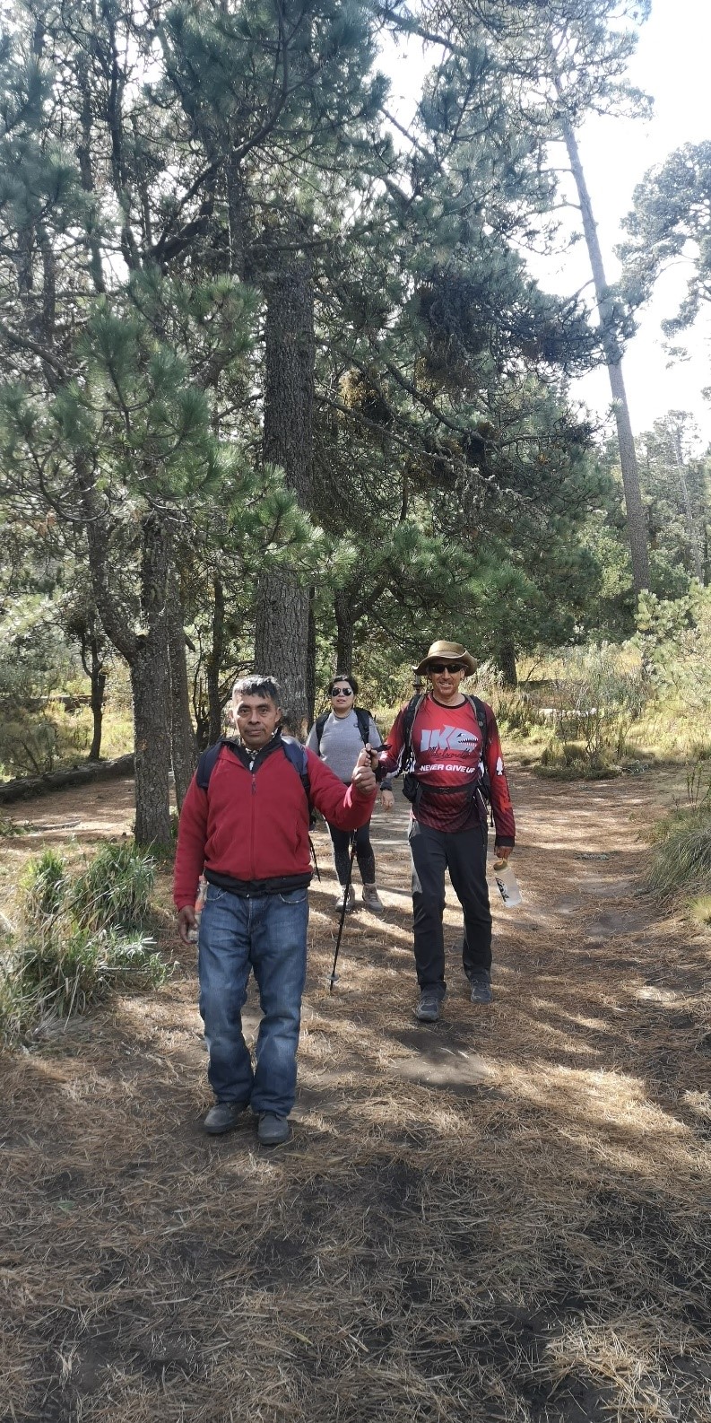
We left on time at 2:00 AM. There was no moon, so headlamps and flashlights were essential. Despite the darkness, it was obvious we were in the forested area and the trail was fairly easy to follow with headlamps. Fortunately, two of the men in our group were Mexicans from the area who between them had climbed Malinche 10 to 20 times before. So, I was in good hands.
In retrospect, this early start was not needed. We did it largely to adjust our sleep cycle for a similar early start two days later on Orizaba. I think a bright an early start at 6AM would suffice. Regardless of when you do start, bring headlamps, in case you don’t return during the daylight.
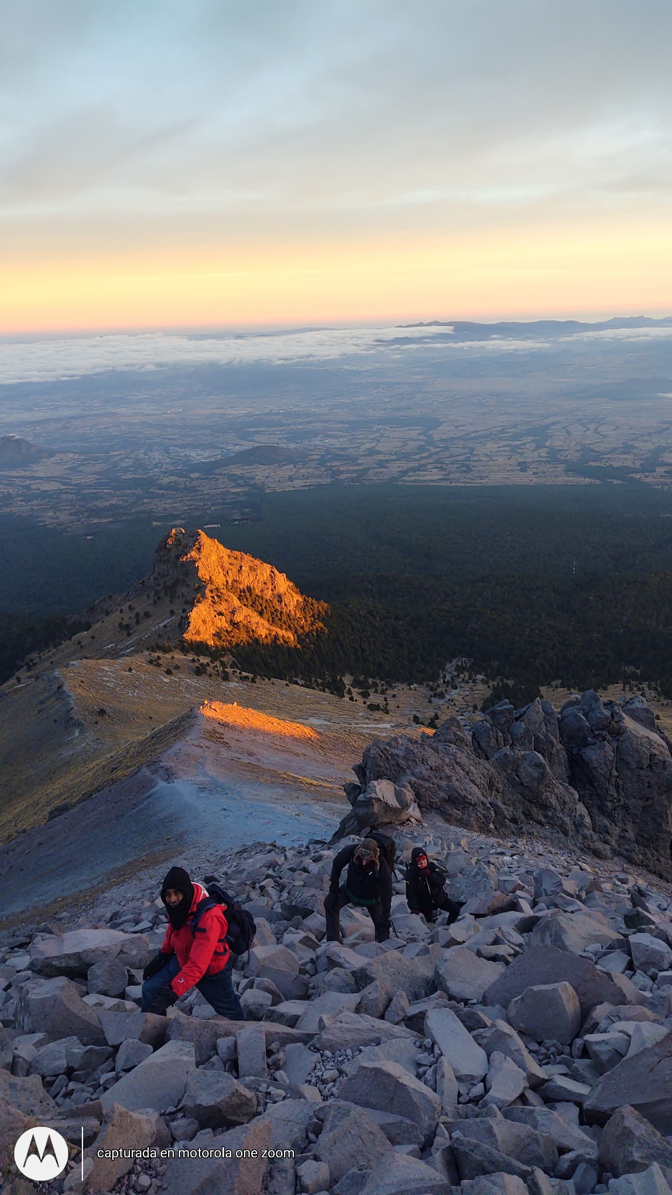
At about 5AM, we rose above the tree line. At this point, the trail changed from being on dirt to rocks. It wasn’t a sudden change, but there was a transitional section that was nice and flat. I would say that by about 7AM, when the sun rose, the rest of the hike was a big rock pile.
Joining the four of us was a stray dog. I thought many times she would give up on us feeding her and turn back, but she never did. She also didn’t walk especially close to anybody most of the time. She walked much faster, going ahead of us, and having a rest while he waited for us to catch up.
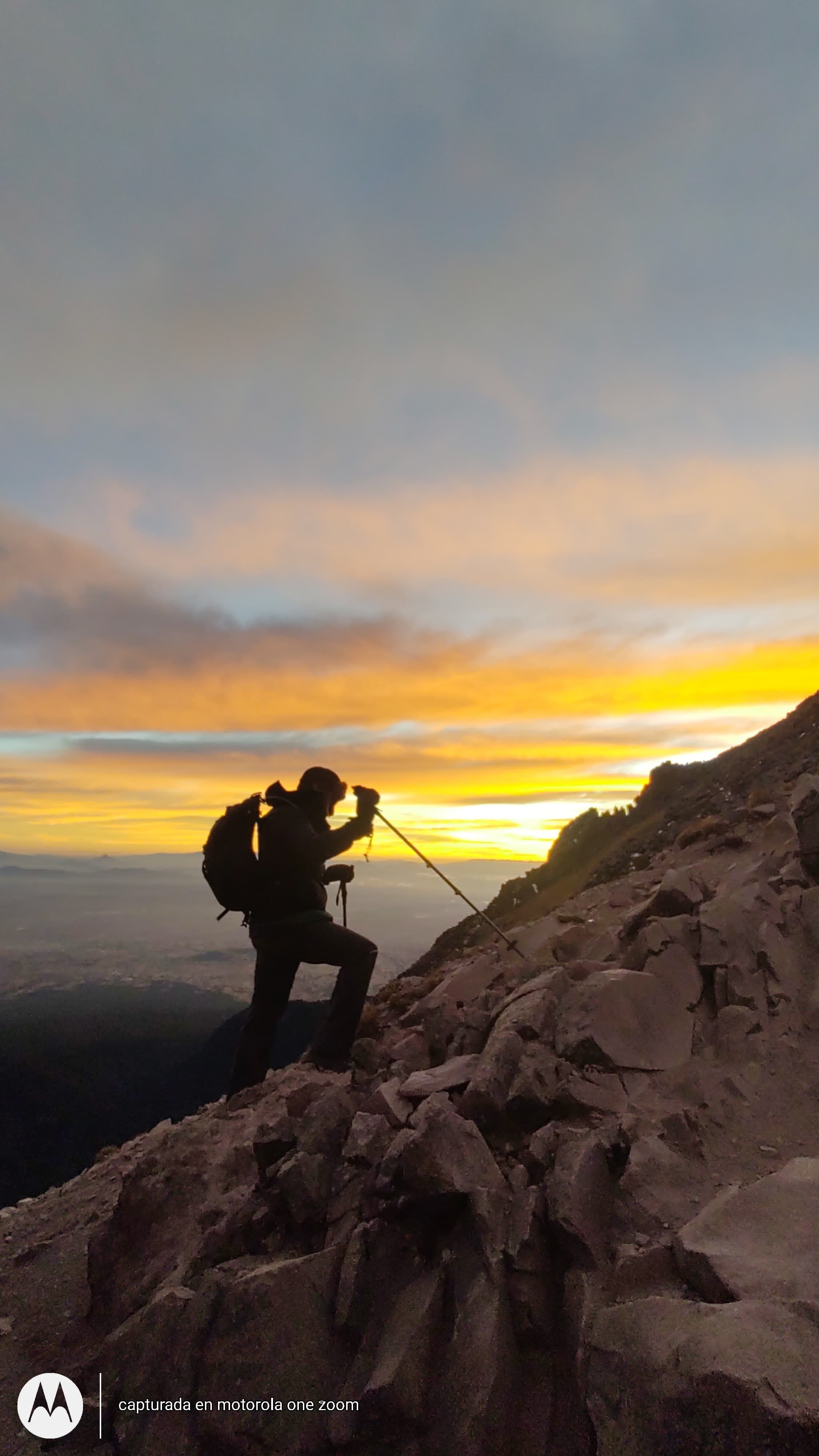
As the sun finally rose, we were greeted to outstanding views of the nearby three highest mountains in Mexico. I already mentioned Popocatépetl and Orizaba, the first and second. We could also see Iztaccihuatl, the third highest, which I’m proud to say I climbed several years ago. Between the volcanoes were many small towns and the big city of Puebla.
The rest of the hike was a scramble up a pile of rocks. It wasn’t clear exactly where the trail was supposed to be most of the time. However, it was hard to get lost as long as you kept going up. I really thought the dog would turn around at this point, hopping from rock to rock, but she didn’t.
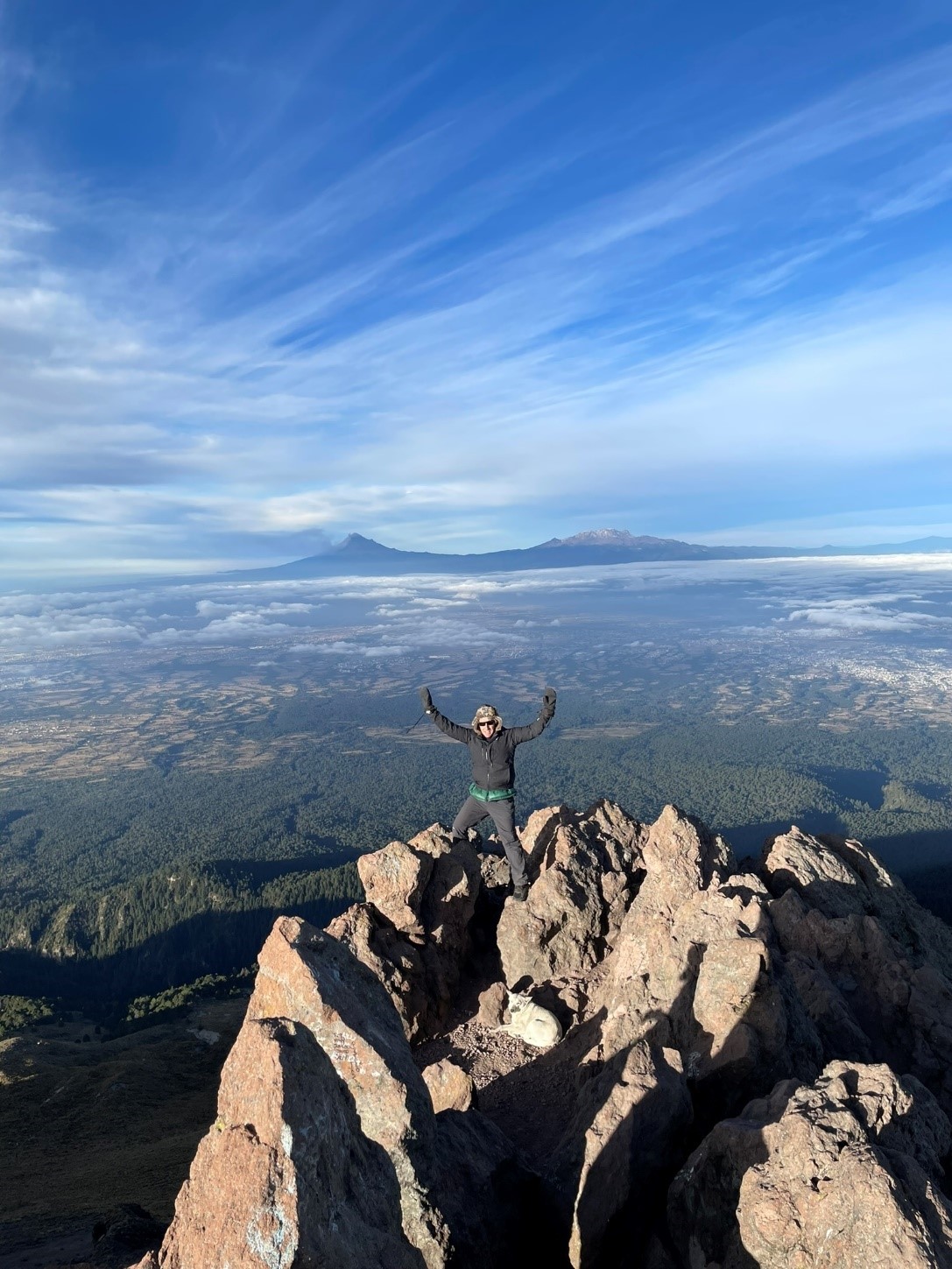
Around 8AM, we reached the summit! Here we enjoyed distant views in all directions, paused for many pictures and gave the dog a well-earned snack. Although the distance each way was only 3.75 miles, progress was slow at this altitude. It took about six hours to get up.
The way down was mostly following our footsteps. However, it was new to me, since I couldn’t see much on my way up in the dark. The descent took about four hours, for a total of ten. Other groups I spoke with at the campground reported times of 5 to 9 hours.
Here are some pictures from our adventure.
If you are in good shape and in Mexico City, I would strongly consider an attempt of Malinche. If you are comfortable driving in Mexico and experienced at climbing, I don’t think you need a guide. However, guides are cheap in Mexico, so it’s an option worth considering. In my case, we fortunately had two capable locals to get us there.
In closing, I would like to thank my friend Celso for driving us to the mountain and leading the trip! I am certainly in his debt, which I hope to partially repay his next Vegas visit. I congratulate him as well as Beatriz and Florente for making it too.
Wikipedia Links: