


Mount Olympus, Washington (part 1)
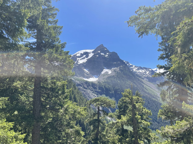
I’m proud to say that I successfully climbed Mount Olympus (Washington) on July 19, 2023. This one has been on my bucket list a long time. It’s the highest point in the Olympic range in western Washington, located in a green and rainy part of the state with glaciated peaks in the middle.
- • Distance = 41.4 miles
- • Elevation at summit = 7,980 feet
- • Total elevation gain = 8,622 feet
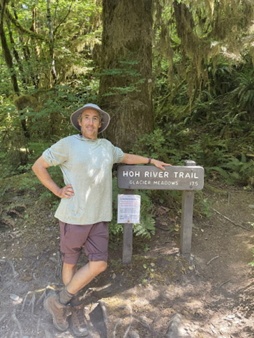
- • Trailhead = Hoh River Trail in Olympic National Park
Mount Olympus has been on my bucket list for a long time. It’s my goal to climb all the most prominent volcanoes and mountains of Washington. Actually, I did a few miles of the trail a few years ago on a family trip. Seeing backpackers returning, apparently victoriously, elevated it on my bucket list.
The top of Mount Olympus is covered with crevasse laden glaciers and the last 100 feet is class 5 (meaning ropes are necessitated) so doing the last bit requires local expertise. At the time, I booked the trip I didn’t know anyone who had done it and had difficulty finding anyone who even heard of it. Whenever I mentioned climbing Mount Olympus the reply was usually, “Do you mean the one in Greece?” If I was to do it, there didn’t seem any alternative that book professional guides, which I did through Northwest Alpine Guides.
Our five-day adventure began at the Olympic National Park Visitor Center in Port Angeles early on July 17. There, the group of five clients and two guides met and did the requisite gear check. Many things on the long list of required items I felt should have been optional, which is a downside to going with an outfitter. After that, we drove separately to the Olympic National Park. Due to limited parking, there was about a two-hour wait to get in. They only let one car enter for every one car that leaves.
We finally hit the trail about 1PM. The trail was wide and only slightly uphill that first day. However, it was still a nine-mile day with heavy packs. I couldn’t fit all my stuff inside my pack, so some items had to hang out of it with carabiners. I became more efficient with this as the trip progressed.
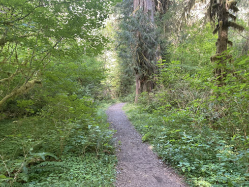
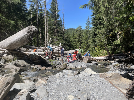
Day 1 was pleasant as we made our way through enormous redwood trees in the Ho Rainforest. The weather was sunny and a bit on the hot side. Stream crossings were frequent, so it wasn’t necessary to carry more than a liter of water. A common topic was whether it was necessary to treat the water before drinking it. The source of the water was melted snow about 20 miles away. I could see the guides were not treating their water and in my educated opinion it was probably okay due its freshness and clarity. Two river crossings on foot were necessitated late in the day.
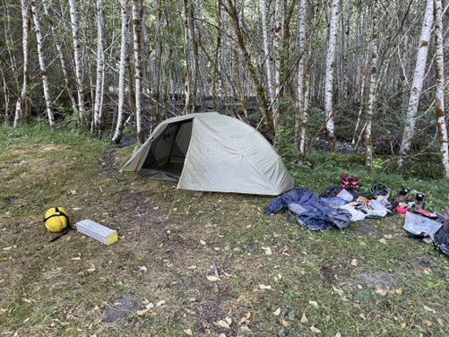
After about six hours of hiking, we arrived at what I think can be called “9 Mile Campground” or the “Olympus Ranger Station Camp.” This was a nice meadow a short walk from the Ho River. We arrived about 7PM worn out from the fast pace of the day. The group got right to setting up tents and the guides heated up water for dinner.
I was told there was a bear wire in another part of the meadow to hang food, so that bears couldn’t reach it. Directions to said wire were vague, but I managed to find what I thought was it near the empty ranger’s station. I would learn on my way back that what I used that day wasn’t a bear wire at all, but a flagpole. It’s a good thing no bear smelled my food bag, as he could have easily knocked the pole down.
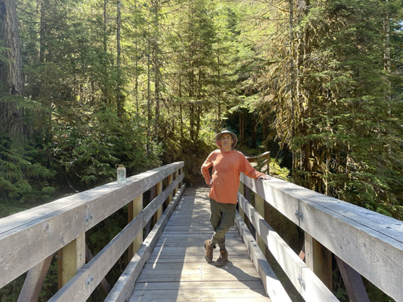
Day 2 would cover about 8 miles, but much more elevation gain. There were still plenty of stream crossing so my plan to never carry more than one liter of water continued to work out well. We left much earlier than day 1, so the guides allowed more frequent and longer breaks.
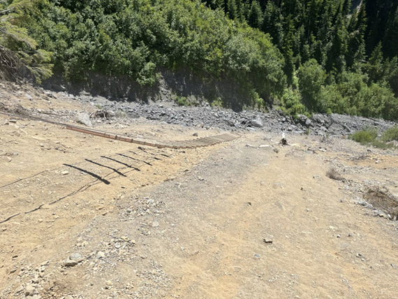
In the late afternoon, we came to a spot where the trail was completely destroyed in an avalanche. To remedy this situation, a cable and wood ladder was laid down, as shown in the following pictures. Due to the possibility of rockfall, the guides had us go one at a time. This process was at times delayed as other groups wanted to go up. I took a nap as I waited my turn.
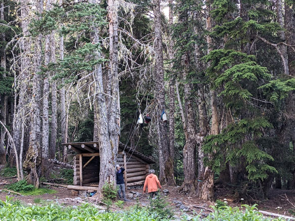
Shortly after the ladder, we arrived at Glacier Meadows Campground. I usually take a picture of my tent at every campground, but I forgot this time. However, the picture below shows the nearby bear wire and an “emergency shelter.” Both this and the previous campground had pit toilets. We had more time to relax at this campground, due to starting earlier. However, it was agreed we would hit the trail for the bit summit day at 5AM, so we all went to sleep early. One of my fellow clients was snoring worse than my junior-year college roommate (which is saying a lot). Out of necessity, I moved my sleeping bag and pad to the nearby emergency shelter. Fortunately, it was warm enough to not need my tent. I could still hear him, but there was a about significant improvement.
In part 2 of this story, I will cover the big 15-hour day 3 as we attempted the summit and return back.
Links