


Mount Shasta
On June 20, 2011, five members of the Las Vegas Mountaineers Club, Joel, Eric, Dan, Al and me, set out to climb one of the highest mountains in the lower 48 states: Mount Shasta. If you haven't heard of it, climbing Mount Shasta is no walk in the park. It is about 7,000 feet of elevation gain up to an altitude of 14,179 feet. Depending on the time of year and snowfall, the climb will be some combination of ice and loose rock. There is no trail; in fact, not even any signage, except the one sign marking the trailhead. The only other permanent sign of the human touch along the route is a hikers' hut, belonging to the Sierra Club, known as Horse Camp. It's about a one hour walk from the trailhead. Technical mountaineering gear (namely a helmet, crampons and ice axe) is necessary for a safe climb. It is not necessary to use rope climbers together, should one have a long fall, although we saw one team using them.
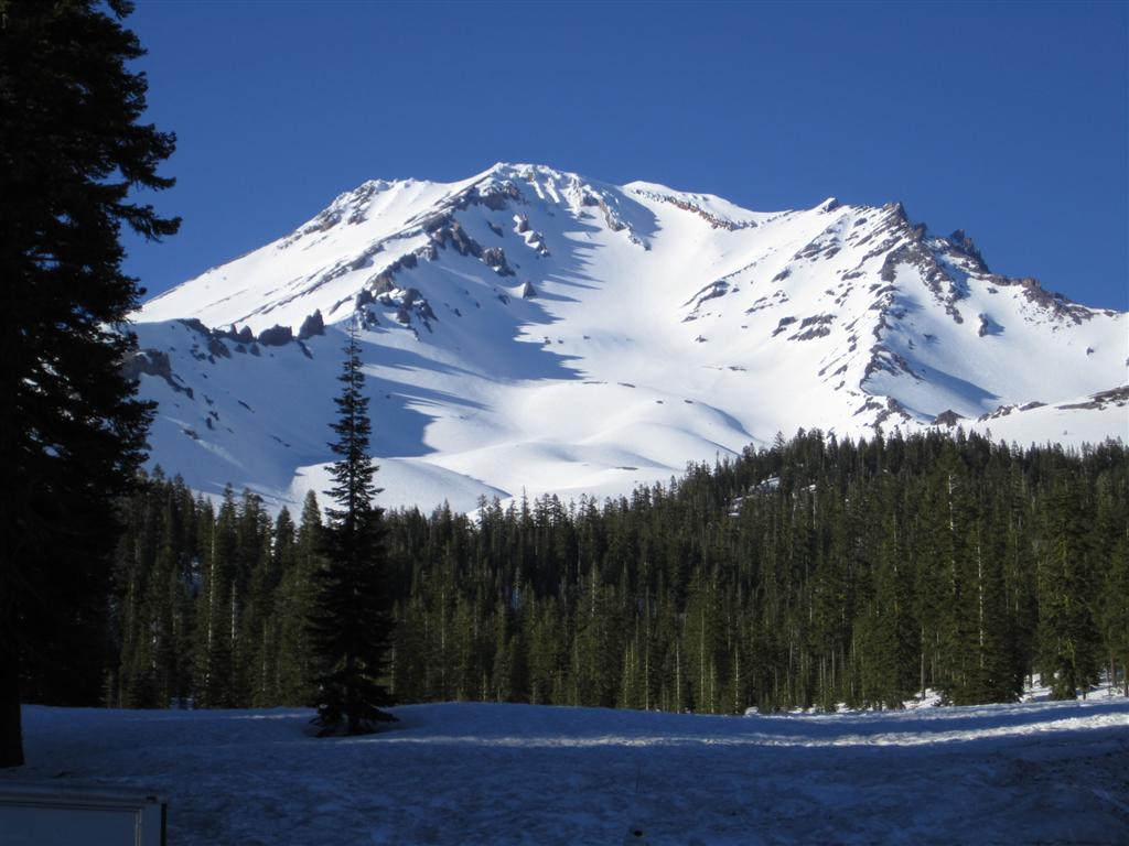
Mount Shasta itself rises up out of nearly flat countryside in northern California, about 50 miles south of the Oregon border. It is near the southern end of a series of volcanoes, known as the Cascades, which extends northward from northern California to southern British Columbia. The main climbing route, which we did, is known as Avalanche Gulch. While this route is only 11 miles round trip, it encompasses 7,262 feet of elevation gain. That is what is brutal about Shasta — it is undeniably steep. By way of comparison, the most common route on Mount Everest, the South Col, has 59% more elevation gain, at 11,535 feet, and that takes about four weeks to do. Okay, maybe that is a bad comparison, but here are some statistics comparing Shasta to some other mountains I have climbed.
Mountains the Wizard has Conquered
| Mountain | Vertain gain (feet) | Distance (miles) | Altitude |
|---|---|---|---|
| Shasta | 7,262 | 11 | 14,162 |
| Whitney | 5,860 | 22 | 14,505 |
| San Gorgonio | 5,419 | 16 | 11,499 |
| Charleston | 4,318 | 17 | 11,918 |
| Baldy (San Antonio) | 3,900 | 12 | 10,064 |
Shasta in late June would normally be only partially covered in snow and ice; however, the winter of 2011 brought levels of snow well above average to the mountains in the western United States. So the route was almost entirely covered in snow. The heavy snow was actually a good thing, since the alternative is hiking on loose rock known as scree, which is both exhausting and makes one vulnerable to rock fall accidents.
The hardness of the snow varies by the hour. It is hard at night and early morning; however, as the sun beats down on it, it gets softer. Soft snow is more difficult to walk through and more prone to avalanches. Those who attempt to climb Shasta in a single day therefore need to start not much after midnight.
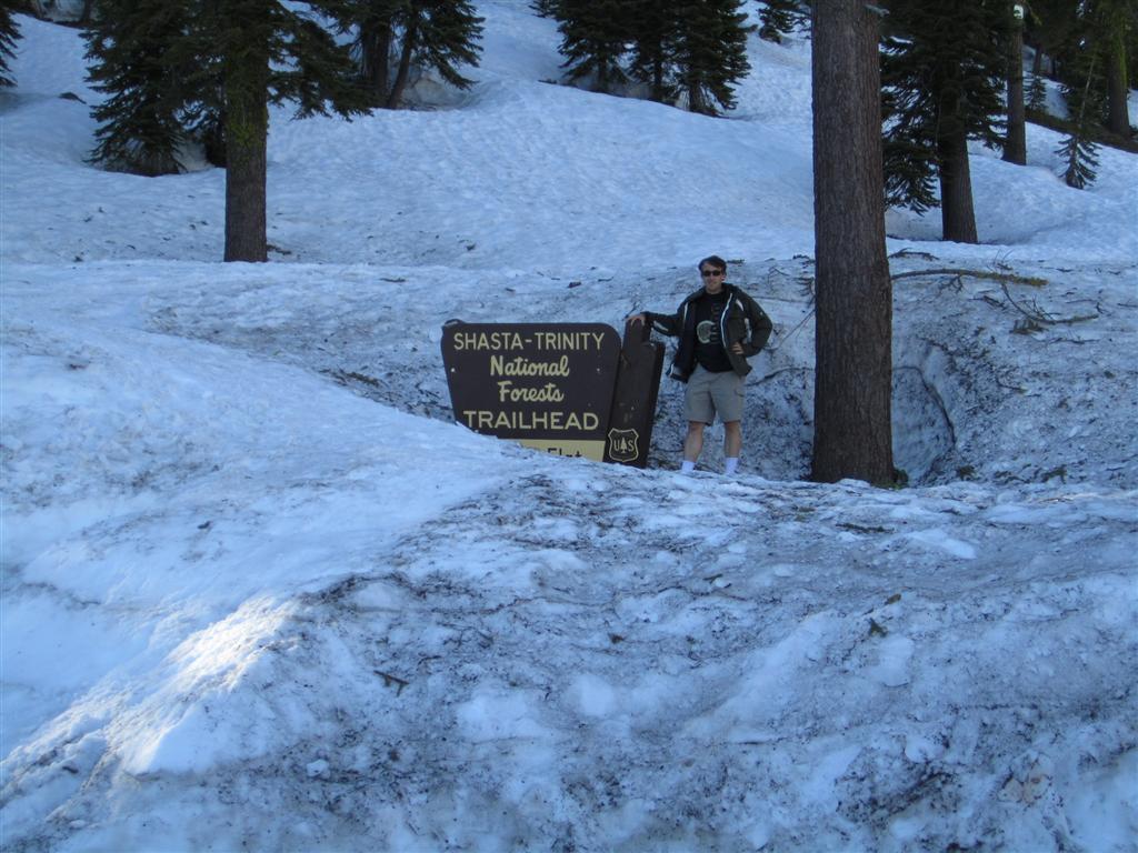
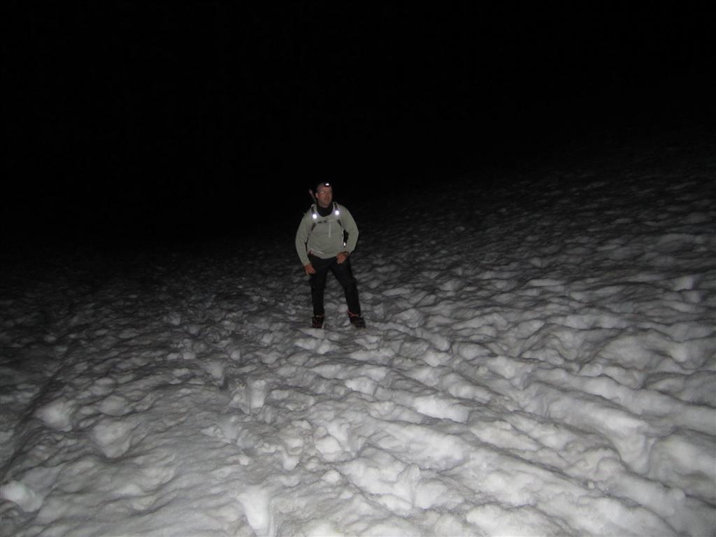
Trailhead on June 19, 2011. It is very unusual
to still have so much snow in June.
The day before the big day, I gathered with two other members of our team, Joel and Eric, at the Bunny Flat Trailhead at about 6:30 PM. The other two members of our team, Dan and Al, were already camped half way up the route at "Helen Lake." I put that in quotes because it is quite a misnomer, as most of the time a lake is nowhere to be seen, completely covered in snow.
It was our plan to leave at 12:30 AM that morning and meet up with the other two at Helen Lake about 4:30 AM for the summit bid. My two companions had warm cars to sleep in, but I had to make due in my tent pitched in the parking lot. Due to loud conversations, cars coming and going, and some very noisy snowmobiles, I got only about two hours of light sleep.
At the appointed time, we packed our gear, donned layers of cold weather clothing, and set out in the darkness. The moon would not rise for another two hours or so, and nowhere is the trail marked. Our knowledge of the route was gained by what we read in books and online reports. By "we," I mainly mean Eric, who did the most homework beforehand. Still, in the midst of snow and trees in the middle of the night, such homework only helps so much. Our collective decision on which way to go pretty much came down to following footprints in the snow of previous climbers. This went fine for a while, but gradually the footprints thinned out and disappeared in patches of very hard snow.
Eric had a GPS, which told him that we were too far off to the right. So we turned to the left a bit, but he still kept repeating that we were still too far to the right every time he checked it. Eventually going left necessitated going down a steep hill covered in trees. When you have a huge mountain to climb, the last thing you want to do is give up gained altitude unnecessarily. However, if we were to get back on the right path, we had no choice. So we walked, and slid at times, down the hillside.
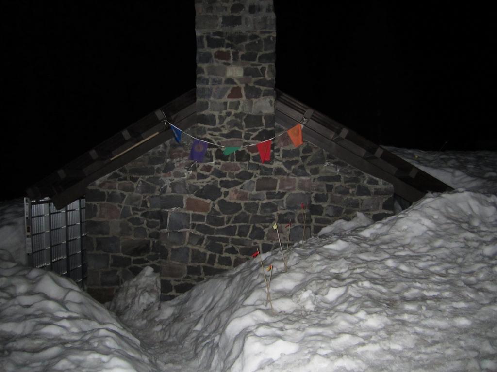
Horse Camp shelter.
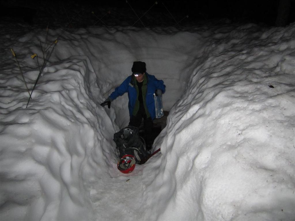
Eric gathering water from Horse Camp spring.
Joel trudging up to Helen Lake in the dark.
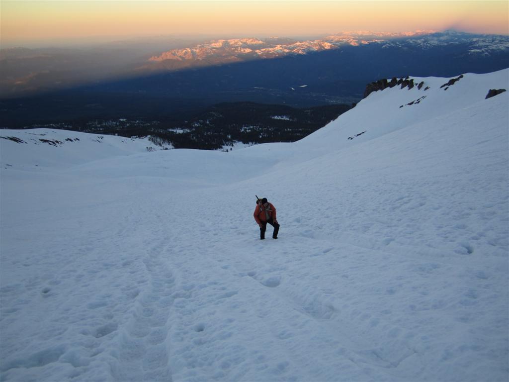
Joel a few hours later, shortly before dawn.
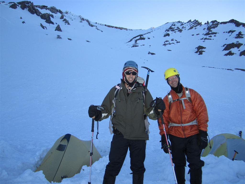
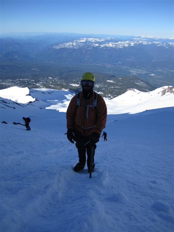
Joel and I at "Helen Lake."
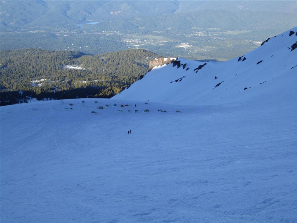
Looking down on Helen Lake.
Looking down along the way up Avalanche Gulch
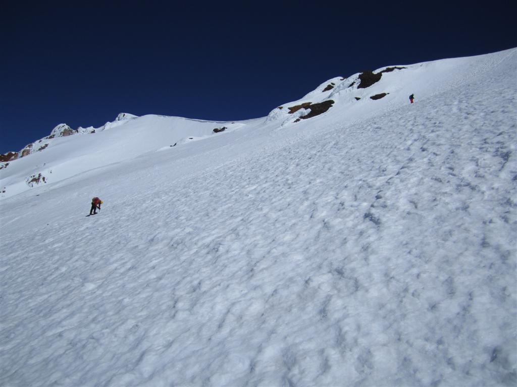
A side view of Avalanche Gulch
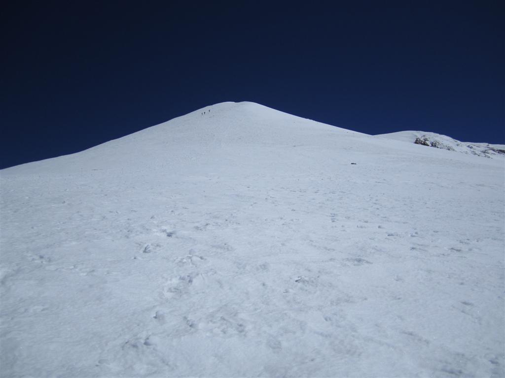
Misery Hill.
Eventually we saw the headlamps of other hikers. We were back on the route, but further along than we had hoped. We had planned a necessary stop at the Horse Camp shelter and spring so we could load up on water. We had to backtrack to get there. It was difficult to find the hut in the dark, because only the roof was exposed due to the high snowfall. All in all, getting lost cost us about an hour of time. It may not sound like much, but when you're facing an enormous physical challenge, you want to be as efficient as possible. In the efficiency department, we were off to a horrible start.
After Horse Camp, it was a comparatively easy climb up to Helen Lake, to join our other two members, Dan and Al. Along the way, Eric declared that he felt he couldn't keep up with our pace and turned back. After that, Joel and I kept climbing as the night turned to day. At about 5:30 AM, we finally reached Helen Lake, which was mostly an empty collection of about 20 tents. Like ants, you could see up the route that the Helen Lake campers, including Dan and Al, had already set out for their summit. We were an hour late, so I couldn't blame them for not waiting. We had two-way radios for such communication, but between confusion over the frequency to use and how to operate the radio in the first place, they were of no help.
Shortly after Helen Lake is when the climbing gets serious. We put on our helmets, readied our ices axes, and headed up Avalanche Gulch like all the other ants in front of us. This part of the route accounts for about half of the total elevation gain. It is the steepest part; an ice axe is needed to help haul yourself up as well as to "self arrest" should you slip and start sliding down. Such uncontrolled falls account for many of the accidents on Shasta. I would later learn that the day before we went up, a hiker fell in this section. All I know is that a helicopter landed at Helen Lake and two rescuers had to climb up to get her and ski her on a stretcher back down to the helicopter. All in all, she had to wait several hours for help.
Personally, I found Avalanche Gulch too steep to go straight up, so I traversed back and forth. It took hours to get to the Red Banks near the top of the ridge, which are a series of rocks that look like red teeth. While it seemed to take ages, at least you could easily see your destination and look down and see what you accomplished. Such visible milestones are good for morale. Once atop the ridge above Avalanche Gulch, the wind immediately picks up. The hiking is, fortunately, less steep for a little while after the Red Banks. The next portion of the climb is the appropriately named Misery Hill. It is even called that on the maps. This is simply a boring, steep slog. Not quite as steep as Avalanche Gulch, but much less interesting as the angle of incline is always the same and all you see is ice in front of you. It is also during the emotionally difficult third quarter: you're exhausted from a long journey but still can't see the light at the end of the tunnel.
As I got closer to the top of Misery Hill, the high altitude, combined with a lack of sleep, was getting to me. I was genuinely concerned about throwing up. I've been above 14,000 feet before, twice on Mount Whitney and once on Mount Langley, and I hadn't had bad experiences. However, on those trips I camped along the way, helping me acclimatize to the thin air. The Shasta route, at 7,262 feet of elevation gain, is also significantly more than Mount Whitey at 5,860. So it isn't just the altitude but how much time you allow yourself to adjust to it.
Other climbers who got a late start kept passing me on Misery Hill. It was along this stretch that my fellow Vegas climbers who camped at Helen Lake passed me on their way down. I told them I was considering turning back, but they encouraged me by saying that I was nearly there and to at least make it to the top of Misery Hill before turning back.
Slowly but surely I finally made it to the top of the hill. I had never read up on the route in advance, so I didn't know what to expect after that. What I saw was the summit in clear view but still a ways off, about half a mile and 300 feet of elevation. There I collapsed for a while to get my head together and compose myself. My partner, Joel, encouraged me to push on, as we were almost there. It was nice of him to wait with me, as the longer you take, the softer the snow gets, making the descent more difficult.
After about a 20-minute rest, I decided I was either going to make the summit or puke, whichever came first. For a brief section after that, the route is mostly flat, actually descending a bit. However, the last 300 feet or so is steep again, along a windy path to the summit. There is no turning back this close to the top. Figuratively, I could smell victory. Literally, I could smell sulfur from vents near the summit. Remember, Shasta is a volcano, erupting about once every 1,000 years.
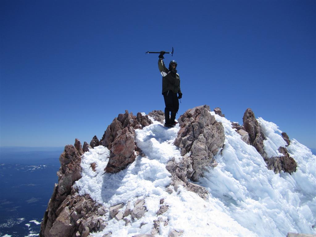
The rest and being able to see the finish line clearly re-energized me, because I found my second wind and made it to the top in decent time. As expected, it was very windy at the summit, but it was a beautiful clear day, allowing views of the valley below and several other peaks in the Cascade and Trinity ranges. I took the obligatory summit photos and a 360-degree panoramic movie. However, the snow was getting mushier by the minute, so we didn't dally too long.
Obviously, the trip down went faster. As is expected, I felt my strength coming back the lower I got, corresponding to the thickening air. Wherever possible, I glissaded, which means to slide down. The snow was still too chunky to glissade down Misery Hill, but the conditions were perfect for most of Avalanche Gulch. In fact, I took a movie of that portion.
Towards the bottom of Avalanche Gulch, the snow got too wet and mushy to glissade further and we had to go on foot again. At one point, I sunk so deep in the snow I had to use my ice axe to dig myself out. We tried to glissade in a few spots after Helen Lake, but for the most part the snow was too soft. So it was a slow, hot march through wet snow back to the car.
In the bright daylight, it was clear where we got lost on our way up. You're supposed to make a left turn into the woods about five minutes after starting. We just didn't know that. I know the Forest Service is trying to keep Shasta as pristine as possible, but I think a few signs to show the way between the parking lot and Horse Camp would be very helpful to midnight hikers. There are already roads, outhouses, and snowmobilers at the base of the mountain, so it isn't like Shasta is a virgin to the human touch.
All in all, the climb took about 15 hours. After everyone was back in the parking lot, we celebrated with a bottle of cheap wine and then descended to a lower and quieter spot to camp for the night. I never slept so well in my life.
In retrospect, for most recreational climbers I would not recommend doing Shasta as a day trip as I did. It certainly made for a good physical challenge, but there is something to be said for taking your time and enjoying the journey, not to mention properly adjust to the altitude. Most people do Shasta in two days and some take three. There are only two choices for camping along the way. The first is the lower and serene Horse Camp. The lower altitude and trees make for good protection from the wind and a lovely spot to spend some time. However, it isn't much higher than the trailhead, so you don't get a significant head start on summit day. The second is the higher Helen Lake camp, which is cold, windy, and crowded. It would require a lot of effort to get the camping gear up that high, but it would make for a much easier summit attempt.
Judging by the number of tents at each spot, most climbers pick Helen Lake. However, if I ever did it again, I would choose Horse Camp. I would start out early to spend as many hours as possible at Horse Camp to acclimatize. Then again, if you're in a hurry, or like harsh conditions, then I would go with Helen Lake.
I hope this account wasn't too boring and maybe I've inspired some readers to attempt it themselves. Of course, conquering Shasta requires being in excellent physical shape, knowing mountaineering techniques like self-arrest, procuring a lot of expensive mountaineering clothing and gear, and preferably securing a partner familiar with the route. All in all, it was a fun and challenging experience that I will never forget and am proud of myself for completing. Stay tuned for my attempt of Mount Rainier, which I plan for the summer of 2012.
 |
 |
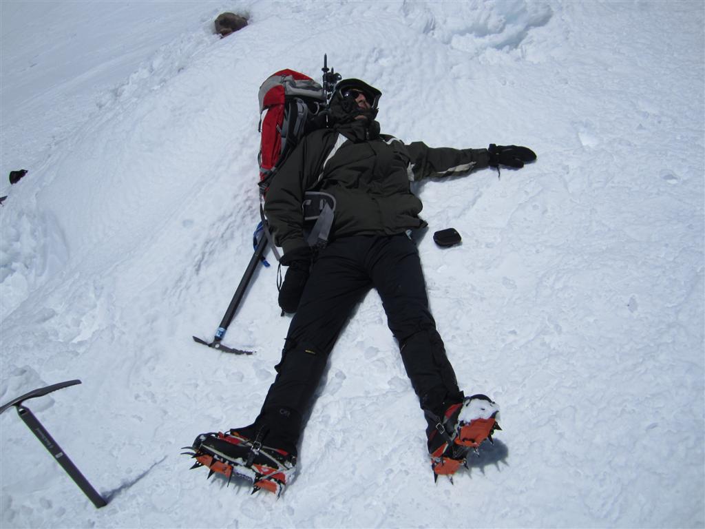
| Atop Misery Hill. I asked Joel to take this picture, to remember both the good times, and the bad. |
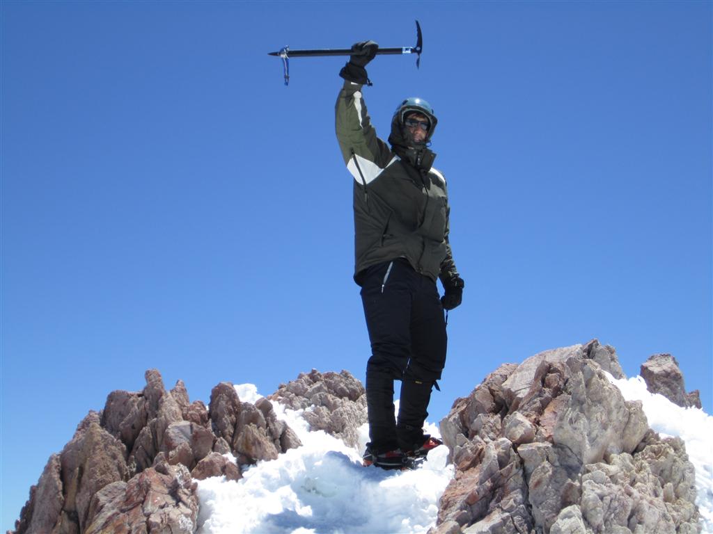
Joel with the summit in the background. |
 |
 |
 |
|
| Looking back on the way down. |
Links
- More photos, posted at meetup.com.
- summitpost.com entry on Shasta. All the dry facts about the mountain.
- peakbagger.com entry on Shasta. More dry facts about the mountain.
- Wikipedia entry.
- Climber dies on Mt. Shasta. Account of a 2008 fatal accident.
- Another Mt. Shasta trip report. From 2005. The writer sacrificed the summit to help an injured stranger.
- Yet another Mt. Shasta trip report. From 2009. It seems like every story involves somebody sliding down the mountain uncontrollably.